Accra

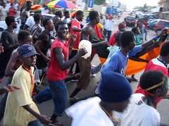
Ghana - USA 2-1
Accra (English: /əˈkr/; Twi: Nkran; ; or Gaga) is the capital and largest city of Ghana, located on the southern coast at the Gulf of Guinea, which is part of the Atlantic Ocean. As of 2021 census, the Accra Metropolitan District, , had a population of 284,124 inhabitants, and the larger Greater Accra Region, , had a population of 5,455,692 inhabitants. In common usage, the name "Accra" often refers to the territory of the Accra Metropolitan District as it existed before 2008, when it covered . This territory has since been split into 13 local government districts: 12 independent municipal districts (total area: 179.0 km2) and the reduced Accra Metropolitan District (20.4 km2), which is the only district within the capital to be granted city status. This territory of 199.4 km2 contained 1,782,150 inhabitants at the 2021 census, and serves as the capital of Ghana, while the district under the jurisdiction of the Accra Metropolitan Assembly proper (20.4 km2) is distinguished from the rest of the capital as the "City of Accra".
Formed from the merger of distinct settlements around British Fort James, Dutch Fort Crêvecoeur (Ussher Fort), and Danish Fort Christiansborg as Jamestown, Usshertown, and Christiansborg respectively, Accra served as the capital of the British Gold Coast between 1877 and 1957 and has since transitioned into a modern metropolis. The capital's architecture reflects this history, ranging from 19th-century colonial architecture to modern skyscrapers and apartment blocks.
Accra is the Greater Accra Region's economic and administrative hub, and serves as the anchor of the larger Greater Accra Metropolitan Area (GAMA), which is inhabited by about 4 million people, making it the thirteenth-largest metropolitan area in Africa. In 2020, the Globalization and World Cities Research Network think tank designated Accra as a "Gamma −" level global city, indicating a growing level of international influence and connectedness.
Etymology
The word Accra is derived from the Akan word Nkran meaning "ants", a reference to the numerous anthills seen in the countryside around Accra. The name specifically refers to soldier ants, and was applied to both the town and people by the Twi speakers.
The name of Accra in the local Ga language is Ga or Gaga, the same name as that of the Ga people and a cognate with Nkran. The word is sometimes rendered with the nasalised vowels as Gã or Gãgã. Historian Carl Christian Reindorf confirmed this etymology, proposing a link between the martial qualities and migratory behavior of the local ants and those of the Ga people. The link between the ethnonym and ants was explicitly reflected in the recognition of anthills as sacred places. Often ringed by sacred fences (aklabatsa), the tall red mounds dotting Accra's hinterland were seen as microcosms of human community and as nodal points between the known world and the world of the dead.
While the Ga used the reference to the invasive species of dark-red swarming ants to connote military prowess and their ancient conquest of Guang speakers residing in the Accra Plains, the Akan-speaking appropriation and translation of this metaphor had a less than generous meaning. Instead of viewing Ga speakers as a formidable military force, the Akan-speaking term "Nkran" cast Ga peoples as pests or nuisances to be controlled or exterminated.
The name Ga is actually a cognate of the name Akan, one of a few words in which g corresponds to k in Akan. Ga also gave its name to the Ga districts surrounding Accra.
The spelling Accra was given to Nkran by Europeans. An earlier spelling used by the Danes was Akra.
History
The main Ga group known as the Tumgwa Were led by Ayi Kushie arrived by sea. When the Guan (Lartehs) on the coast saw them on their canoes at sea, they looked like ants. Hence, the Lartehs refer to them as Nkran (ants). Nkran was later corrupted by the Danes to Akra, then to present-day Accra. Nkran in the Ga language is Gaga, thus they also started calling themselves Ga. Due to their sheer numbers, the indigenous Lartehs thus relocated to the Akuapem ridge.
Initially, Accra was not the most prominent trading centre; the trade hubs of the time were the ports at Ada and Prampram, along with the inland centres of Dodowa and Akuse. The Dutch built the nearby outposts of Ussher Fort while the British and the Swedes built James Fort and Christiansborg castles, respectively. By the 17th century, Portugal, France and Denmark, had constructed forts in the city.
Britain gradually acquired the interests of all other countries beginning in 1851, when Denmark sold Christiansborg (which they had acquired from the Swedes) and their other forts to the British. The Netherlands was the last to sell out, in 1871. In 1873, after decades of tension between the British and Ashantis, the British captured Kumasi, destroying portions of the city. The British then captured Accra in 1874, and in 1877, at the end of the second Anglo-Asante War, Accra replaced Cape Coast as the capital of the British Gold Coast. This decision was made because Accra had a drier climate relative to Cape Coast. Until this time, the settlement of Accra was confined between Ussher Fort to the east and the Korle Lagoon to the west.
As the newly established Gold Coast's administrative functions were moved to Accra (1877), an influx of British colonial administrators and European settlers grew around the Christiansborg (modern Osu, Ministries, Ridge, Labone, and Cantonments) began, and the city began to expand to accommodate the new residents. Victoriaborg was formed in the late 19th century as an exclusively European residential neighborhood, located to the east of the city limits of the time. The boundaries of Accra were further stretched in 1908. This expansion entailed the creation of a native-only neighborhood, intended to accommodate members of the native population as a means of relieving congestion problems in the overcrowded city center. Adabraka was thus established to the north of the city.
One of the most influential decisions in the history of the city was that of building the Accra-Kumasi railway in 1908. This was to connect Accra, the country's foremost port at that time, with Ghana's main cocoa-producing regions. In 1923, the railway was completed, and by 1924, cocoa was Ghana's largest export.
The colonial era heavily influenced the shape that Accra took during this period. For example, the segregation of European and African neighborhoods was mandated by law until 1923, and all new buildings were required to be built out of stone or concrete. Despite these regulations, European settlers in the Gold Coast were very hesitant to invest any large amount of money into the city to maintain its infrastructure or improve public works. This did not change until the governorship of Sir Frederick Gordon Guggisberg during which period the three separate settlements (Osu, La and Jamestown) merged to become modern Accra. Guggisberg's administration laid out the present grid networked neighborhoods of Tudu, Adabraka and Asylum Down.
Among the achievements of Guggisberg was the building of a bridge across the Korle Lagoon in 1923, which opened the land west of the lagoon for settlement. Guggisberg also oversaw the building of a major hospital (Korle-Bu) and secondary school (Achimota). Such improvements led to an increase in Accra's population due to the migration of rural dwellers into the city, and the immigration of increasing numbers of British businessmen and administrators.
After World War II
In the years following World War II, the neighbourhoods of Ridge and Cantonments were planned as low-density developments for Europeans, while many rural migrants settled in neighbourhoods which had not yet been incorporated into Accra's municipal boundary, such as Nima and surrounding areas. Thus, the development of these neighbourhoods was unregulated by the government, creating a crowded and jumbled shanty-town landscape.
Another area of Accra that took shape at this time was the central business district (CBD). More administrative buildings were built on High Street, forming a massive judicial/administrative complex. Additionally, the expansion of the economy led to many more commercial buildings being built in the CBD.
In 1944, Accra's city planner Maxwell Fry devised a town plan, which was revised in 1958 by B.D.W. Treavallion and Alan Flood. Although the Fry/Trevallion plan was never followed through, it illustrated the British vision of how Accra should develop.
Fry/Treavallion plan
In the Fry/Treavallion plan, a reorganization of the CBD was called for, as well as the development of the coastal region of the city. To reorganize the CBD, the planners decided to superimpose a tight street grid north of Fort Ussher.
To the east of this newly organized CBD, the planners hoped to preserve a broad, open space for a restaurant, country club, and polo and cricket fields. Additionally, the British planners intended to build large numbers of public squares, fountains, and ornamental pools and statues throughout the city, as well as a vast Parliament Complex in the city center. Lastly, the Fry/Treavallion plan included plans to make the coastal region an extension of the exclusive European neighborhood of Victoriaborg, and to create a recreational preserve for the elite. However, the British Gold Coast ended before the Fry/Treavallion plan was enacted.
Nkrumah Plan
When Kwame Nkrumah became Ghana's first post-independence Prime Minister in 1957, he created his own plan for Accra's development. Instead of creating spaces to serve the elite, Nkrumah sought to create spaces to inspire pride and nationalism in his people and people throughout Africa.
Rather than creating ornamental fountains and a large Parliament complex, Nkrumah decided to build landmarks such as Independence Square, the State House, and the Organisation of African Unity building, and to refurbish Christianborg Castle. Nkrumah dec…