Baja California Sur
Baja California Sur (Spanish: [ˈbaxa kaliˈfoɾnja ˈsuɾ]; 'South Lower California'), officially the Free and Sovereign State of Baja California Sur (Spanish: Estado Libre y Soberano de Baja California Sur), is the least populated state and the 31st admitted state of the 32 federal entities which comprise the 31 States of Mexico. It is also the ninth-largest Mexican state in terms of area.
Before becoming a state on 8 October 1974, the area was known as the El Territorio Sur de Baja California ("South Territory of Lower California"). It has an area of , or 3.57% of the land mass of Mexico, and occupies the southern half of the Baja California Peninsula, south of the 28th parallel, plus the uninhabited Rocas Alijos in the Pacific Ocean. It is bordered to the north by the state of Baja California, to the west by the Pacific Ocean, and to the east by the Gulf of California. The state has maritime borders with Sonora and Sinaloa to the east, across the Gulf of California.
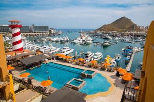
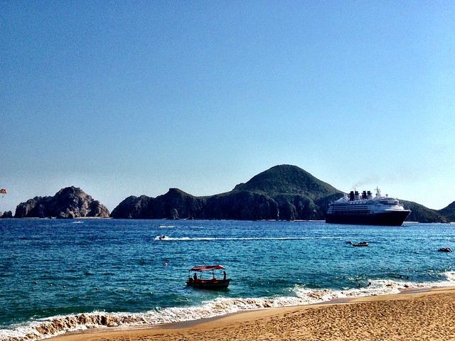
The state is home to the tourist resorts of Cabo San Lucas and San José del Cabo. Its largest city and capital is La Paz.
Etymology
The state is named after the peninsula on which it is found, Baja (Lower) California, with the term "Sur" meaning "south". The name California applied to this peninsula along with the area now known as the state of California in the United States. The coat of arms emphasizes the state's connection to the sea, including images of silver fish, a silver shell and a blue background.
History
Pre-Columbian era
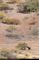
Japanese archaeologist Harumi Fujita, who has been excavating the Cape Region since 1985, has carbon-dated remains from the Babisuri Shelter on the Isla Espíritu Santo to 40,000 years ago, placing the earliest habitation date in the Archaic period, though the majority of remains indicate indigenous people have constantly occupied the area from between 10,000 and 21,000 years ago. Evidence of early human habitation is found in primitive rock and cave paintings dating to 1700 BCE, created by hunting and gathering societies that lived in rock shelters. The state is one of five areas in the world with important concentrations of cave paintings. These paintings have an identifiable style and tend to be on a monumental scale with some figures as tall as four meters. Most of the animals are painted in silhouette and depicted in movement, often being hunted by people. The best known site is the Great Mural Rock Art which dates from 1700 BCE, located in the north of the state. Other important sites include Cueva de Palma, San Gregorio, Santa Teresa, Guadalupe, San Francisco, Cabo Pulmo, Santiago and San Borjita. The most important concentrations are in twelve square kilometer zone in the north of the state, centered on the Sierra de San Francisco. In sites near Comondú, Las Palmas and Cocheros, there are also arrowheads, utensils and petroglyphs. Las Palmas contains secondary burials of human bones painted with red ochre.
When the Spanish arrived, there were four main ethnic groups: the Pericúes in the south between Cabo San Lucas and La Paz, the Guaycuras in the area north of the Pericú to Loreto, the Monquis near Loreto and Cochimí in the middle of the peninsula. All were hunter/gatherers without agriculture or metalworking, but produced pottery. They also fished, but only the Pericúes had rafts.
Colonial era
The first Spaniard in the area is believed to be Fortún Ximénez, arriving in 1533. He and his crew did not remain long because they sacked the area's pearls and abused the women, prompting a violent confrontation with the natives, who killed Ximénez. The remaining crew returned to Mexico City with the pearls and stories of riches.
In 1535, Hernán Cortés navigated into the Gulf of California, which he called the Sea of Cortés. He landed in what is now the bay of La Paz, which he named the Santa Cruz Port and Valley. This event is celebrated in La Paz as its founding. However, he did not remain.
Despite various explorations, the remoteness of the region impeded efforts at colonization until the 17th century. In 1697, Jesuit missionary Juan María de Salvatierra established the Nuestra Señora de Loreto Conchó Mission, the first permanent one of its kind in Baja California Sur. From there the order spread through most of the current state, founding sixteen missions in territory of the current state to work among the Pericú, Guaycura and Cochimí peoples.
During the 18th century, more colonists arrived, bringing diseases that caused a significant decrease in the indigenous population.
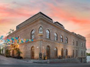
In 1768, the Jesuits were expelled from New Spain and the Franciscans took over the missions, continuing the expansion north. In 1773 they were replaced by the Dominicans. A number of these mission churches still survive, including the Loreto Mission, the La Paz Cathedral, the San José del Cabo Mission and the San Javier Mission.
19th century
The missions' influence had waned by the start of the nineteenth century, with most closing. However, many of the mission facilities became the centers for ranching operations and some agriculture. Without the protection of the monks, and the lack of governmental control, the indigenous peoples of this time were abused by the ranchers.
In the early 19th century, Baja California was divided into four municipalities, Loreto, San José del Cabo, San Pedro Mártir and Santa Gertrudis.
The southern peninsula's isolation kept it out of the fighting during the Mexican War of Independence. Although this war ended in 1821, the remoteness of the area allowed the Spanish to maintain control of the southern peninsula until 1822. Afterwards, it was divided into four municipalities by Guadalupe Victoria and governor José María Echendía.
Loreto was the original capital of the peninsula until 1830, when destruction of the town by heavy rains forced the government's relocation to La Paz, which has been the capital since.
The United States invaded the peninsula during the Mexican–American War and wanted it as part of the Treaty of Guadalupe Hidalgo, but the Mexican government succeeded in keeping control of the territory. In 1853, William Walker and 45 other Americans captured La Paz. However, due to lack of official U.S. support they were quickly driven out by Mexican forces.
During the Reform War, Liberal forces under General Manuel Marquez de Leon and others captured La Paz. French forces then invaded the country to support the Conservative cause, and Governor Felix Gilbert recognized Emperor Maximilian. However, Mexican forces under Benito Juarez forced the French out, with Coronel Clodomiro Cota, recapturing the peninsula from the French.
The division of the peninsula into north and south occurred in 1888 by the federal government under Porfirio Diaz.
20th century to present
During the regime of Porfirio Diaz (1876 to 1910), the Mexican government invited foreign enterprises to enter the country to develop it. In Baja California, these included mining operations including a major French mine called El Boleo (near Santa Rosalia) and the establishment of maritime routes. This president also divided the peninsula into two parts, each with its own government.
The southern peninsula was not involved in the Mexican Revolution until after the assassination of Francisco I. Madero, when troops were organized in opposition to Victoriano Huerta, his successor under Félix Ortega. These troops defeated federal troops in 1914 and took over La Paz.
From the end of the Mexican Revolution to 1974, the territory had ten governors appointed by the federal government. The division of the peninsula was further formalized in 1931, with a highway extending its length the same year. Infrastructure development remained a priority for the area, with the establishment of schools including the first teachers’ college in 1942, and projects to provide water and electricity.
The southern territory became a state on 8 October 1974, with three municipalities: La Paz, Comondú and Mulegé. Two others have been carved out since then, Los Cabos (1981) and Loreto (1992).
Geography
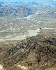
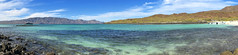
The state is on a narrow peninsula which broke away from the mainland about two million years ago due to tectonic activity. The territory is primarily mountains or mountain ranges and coastal plains. The mountain ranges parallel the coastline and are of volcanic rock. The local name for the main mountain range is the Sierra de la Giganta and the highest peak is the Sierra de la Laguna at 2080m above sea level. The coastal plains are significantly wider on the Pacific side, averaging about 40 km, with much wider plains such as those of Santa Clara, Berrendo and Magdalena y Hiray. These areas are dominated by sedimentary rock, especially limestone of marine origin.
The state is divided into five regions: Central Desert, La Serranía, the Vizcaíno Desert, the Magdalena Plains and Los Cabos. The Central Desert has desert plants, with vegetation springing up during short and irregular rains. The La Serranía is the high mountain areas with significant tree cover, some species of which are commercially valuable. The Vizcaíno Desert runs along the Pacific coast around the Ojo de Liebre and San Ignacio lagoons; it contains lower mountain ranges such as the San Francisco, San Alberto, Las Tinajas de Murillo and El Serrucho, along with the El Azufre and Las Vírgenes volcanos. The Magdalena Plains is a large, flat area near the Pacific coast, and the Los Cabos region is distinguished by microclimates determined by the geologic change in the area and rain patterns.
The climate of the state is dry, with an average annual temperature of 18–22 °C and average annual rainfall of less than 200mm. The lower elevations are the driest and hottest, with summer daytime temperatures above 40 °C; wintertime temperatures may fall below freezing. The exception to desert conditions is the Los Cabos region, classified as semi-moist because of Pacific hurricane activity which affects the region. In the spring, prevailing winds are…