Haute-Normandie

Upper Normandy (French: Haute-Normandie, French: [ot nɔʁmɑ̃di];) is a former administrative region of France. On 1 January 2016, Upper and Lower Normandy merged becoming one region called Normandy.
History
It was created in 1956 from two departments: Seine-Maritime and Eure, when Normandy was divided into Lower Normandy and Upper Normandy. This division continued to provoke controversy, and many people continued to call for the two regions to be reunited. The two regions were finally merged on 1 January 2016. The name Upper Normandy existed prior to 1956 and referred by tradition to territories currently included within the administrative region: the Pays de Caux, the Pays de Bray (not that of Picardy), the Roumois, the Campagne of Le Neubourg, the Plaine de Saint-André and the Norman Vexin. Today, most of the Pays d'Auge, as well as a small portion of the Pays d'Ouche, are located in Lower Normandy. Rouen and Le Havre are important urban centers.
Major communities
Rouen is the regional capital, historically important with many fine churches and buildings, including the tallest cathedral tower in France. The region's largest city, in terms of municipal population, is Le Havre, although Rouen is by far the most populous urban area and metropolitan area. The region is twinned with the London Borough of Redbridge in England. Its economy is centered on agriculture, industry, petrochemicals and tourism.
Bernay
Dieppe
Évreux
Fécamp
Le Grand-Quevilly
Le Havre
Le Petit-Quevilly
Louviers
Mont-Saint-Aignan
Rouen
Saint-Étienne-du-Rouvray
Sotteville-lès-Rouen
Vernon
External links
- Upper Normandy : a haven of peace – official French website
(49°30' 1°)


Hotels Haute-Normandie
 Hôtel Littéraire Gustave Flaubert, BW Signature CollectionRouen
 Holiday Inn Express - Le Havre CentreLe Havre
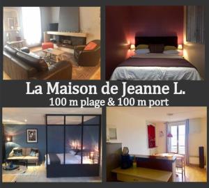 La Maison de JeanneDieppe
 Le Domaine des pins - Maison 2 Chambres vue merLe Tréport
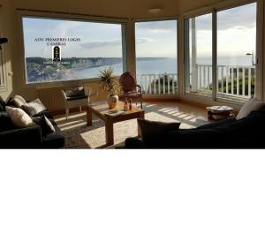 Aux Premières LogesFécamp
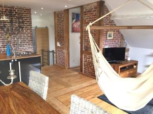 Le Loft du ClochetonÉtretat
 Maison Fleurs de Lys, climatisée, WiFi et Parking Privée Gratuit, Lave-Linge, Vernon GivernyVernon
 Comfort Hotel EvreuxÉvreux
Looking for places related to Haute-Normandie?
Those are other destinations to find places related to Haute-Normandie: