Ivano-Frankivs’ka Oblast’
Ivano-Frankivsk Oblast (Ukrainian: Іва́но-Франкі́вська о́бласть), also referred to as Ivano-Frankivshchyna (Ukrainian: Іва́но-Франкі́вщина), is an oblast (region) in western Ukraine. Its administrative center is the city of Ivano-Frankivsk. It has a population of
The area, also known as Prykarpattia, was part of the historical region of Galicia, where the Kingdom of Galicia–Volhynia flourished. After World War I, the area became part of the Second Polish Republic and was administered as part of Stanisławów Voivodeship until the invasion of Poland. The area was annexed by the Soviet Union and was known as Stanislav Oblast until 1962, when its administrative center was renamed after the Ukrainian writer Ivan Franko. Kolomyia was a historical center of the oblast and remains a major cultural center of Pokuttia, the traditional name for the southern part of the oblast.
Name
On November 9, 1962, a decree was issued by the Presidium of the Verkhovna Rada of the UkrSSR, according to which: "Taking into account the wishes of the labor collectives of the city and region, the Presidium of the Verkhovna Rada of the USSR decided to rename the city of Stanislav (Stanislaviv) to Ivano-Frankivsk, and the Stanislav Oblast to Ivano-Frankivsk Oblast." The renaming was timed to the 300th anniversary of the city's founding and in honor of the outstanding Ukrainian writer Ivan Franko.
As with the rest of Ukraine's oblasts Ivano-Frankivsk may also be known by its matronymical name Ivano-Frankivshchyna (Ukrainian: Івано-Франківщина). However, that name did not receive general public acceptance and commonly Ivano-Frankivsk Oblast is almost always called Prykarpattia (en. Prekarpathians) – a historic name for the same region. (Geographically the historic region covers a much larger portion of Ukraine than just the Ivano-Frankivsk region) Formerly as Stanislavshchyna or Stanyslavivshchyna – Ukrainian: Станіславщина, Станиславівщина.
Geography
Ivano-Frankivsk Oblast borders Lviv Oblast to its north and west, Zakarpattia Oblast to its south-west, has a 50-km long state border with Romania (Maramureș County) to its immediate south, and it borders Chernivtsi Oblast to the south-east and Ternopil Oblast to the east. It is situated partly in the Eastern European Plain and partly Carpathian Foothills. The oblast may be divided into three regions: mountainous, pre-mountainous, and plains.
The climate is mildly-continental and damp with cool summers and mild winters. The average monthly temperature in June is with in the mountains. The average monthly temperature in January is with in the mountains. Average precipitation varies annually around with in the mountains.
Relief
The region is situated between two main regional tectonic plates: Carpathian fold belt and Volhynia-Podillya plate. The most prominent features of the first one are the Carpathian Mountains, while the second one - Dniester river.
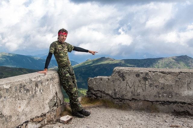
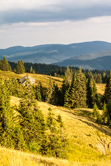
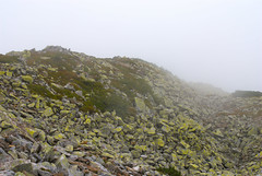
The Carpathian Mountains contribute tremendously to the change in relief of Ivano-Frankivsk Oblast and their elevation rises from north-east to south-west stretching along the oblast's south-western border. The elevation of the oblast varies from 230m to 2,061m above sea level. The mountains occupy almost one half of the whole Oblast and consist of two main mountain ranges: the Gorgany (highest peak – Mt. Syvulya Major (1,836m)) and the Chornohora range (highest peak – Mt. Hoverla (2,061m)).
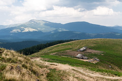
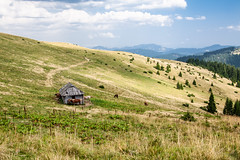
The rest of Ivano-Frankivsk Oblast is located within the Dniester river and Prut river valleys. The plains of the oblast are part of the Carpathian Foothills and Opillia Upland (part of Podillia Upland) which are cut through by Dniester. The upland has a temperate-climate habitat mixed with grassland and woodland – also known as the forest steppe. The relief of the region consists mostly of rolling hills of 230-400m over the sea level. Near river valleys are common canyons and ravines.
A particular feature of the southern region of the Ivano-Frankivsk Oblast is Stanislav Canyon, in the so-called Kherson Mountains, a deep cut in the local topography where episodic water flowing into the Baltic has steeply eroded a canyon formation.
The Dniester flows mainly through the Halych Raion and along the administrative border between Ivano-Frankivsk and Ternopil Oblasts. The territory of the region within immediate proximity to the river is traditionally known as Opillia. Opillia, however, stretches far beyond the oblast and only covers two of its raions: Halych Raion and Rohatyn Raion, both located in the north. Relief in the area consists of rolling hills uplands.
The Carpathian foothills consist mostly of low denudation accumulative uplands, while the right bank of Dniester along the border with the Ternopil Oblast depicts karst type relief of Pokuttia Upland. Because of it near that area along Dniester relief shows forms of canyon. Pokuttia Upland between Bystrytsia of Nadvirna and Prut River (Prut-Bystrytsia Upland) serves as drainage divide within the oblast between Dniester and Prut. Carpathian foothills have two depressions: one is at the confluence of Bystrytsia of Solotvyn, Bystrytsia of Nadvirna, Vorona and Bystrytsia rivers, called Bystrytsia Depression, and another is around the city of Kalush, called Kalush Depression.
Hydrology
Ivano-Frankivsk Oblast has a plethora of rivers, waterfalls, mountainous brooks, and smaller ponds, but there is almost no other type of bodies of water such as lakes and water reservoirs. Most of rivers either flow into Dniester or Prut River (tributary of Danube). The total water drainage area of the region is . Segments of Dniester and Cheremosh River are used as administrative borders with Ternopil and Chernivtsi oblasts respectfully.
The water drainage divide between Dniester and Prut cuts the region through middle of following districts: Nadvirna Raion, Kolomyia Raion, Tlumach Raion, and Horodenka Raion.
Nature Sanctuaries
The region is a home to some 456 preserved areas (on June 1, 2006) of some , 30 out of which are of all-national importance with an area of and the rest of a local importance. In the Ivano-Frankivsk Region is located a strict nature reserve Gorgany that was created in 1996. There are five national parks in the region. There are numerous natural monuments of feature and habitat management areas (zakazniks).
| Park | District |
|---|---|
Carpathian National Nature Park | Verkhovyna / Nadvirna | |
| National Nature Park Hutsulshchyna | Verkhovyna |
| Halych National Nature Park | Halych |
| Verkhovyna National Nature Park | Verkhovyna |
| National Nature Park Synyohora | Bohorodchany |
| Nature Preserve | District |
|---|---|
Nature Preserve Gorgany | Nadvirna |
Regional subdivisions
Since July 2020, Ivano-Frankivsk Oblast is administratively subdivided into six raions. These are
- Ivano-Frankivsk Raion
- Kalush Raion
- Kolomyia Raion
- Kosiv Raion
- Nadvirna Raion
- Verkhovyna Raion
Primary divisions
The Ivano-Frankivsk Oblast is administratively subdivided into 14 districts (raions) as well as 6 cities (municipalities) which represent a separate raion and in direct subordination to the regional government, among which are Bolekhiv, Kalush, Kolomyya, Yaremche, and the administrative center of the region, Ivano-Frankivsk. Burshtyn became the 6th city of regional importance in 2014. The formation of the region was established in 1921 in the Second Polish Republic and was in majority preserved during the Soviet times. Most of the districts (former powiats) were reestablished as well in 1960s. The major industrial and cultural centers of the region were given a wider form of autonomy and assigned as the cities of regional subordination.
| No. | Name | Created | Arms | Administrative center | Area (km2 / sq mi) | Population (2001) |
|---|---|---|---|---|---|---|
| 1 | Bohorodchany Raion | January 1, 1947 | Bohorodchany (Urban-type settlement) | 70,212 | ||
| 2 | Verkhovyna Raion | December 8, 1966 | Verkhovyna (Urban-type settlement) | 30,079 | ||
| 3 | Halych Raion | January 1, 1947 | Halych (City) | 65,640 | ||
| 4 | Horodenka Raion | January 1, 1947 | Horodenka (City) | 60,881 | ||
| 5 | Dolyna Raion | January 1, 1947 | Dolyna (City) | 71,059 | ||
| 6 | Kalush Raion | January 1, 1947 | Kalush (City) | 62,883 | ||
| 7 | Kolomyia Raion | January 1, 1947 | Kolomyia (City) | 105,940 | ||
| 8 | Kosiv Raion | January 1, 1947 | Kosiv (City) | 90,167 | ||
| 9 | Nadvirna Raion | January 4, 1965 | Nadvirna (City) | 113,508 | ||
| 10 | Rohatyn Raion | January 4, 1965 | Rohatyn (City) | 51,125 | ||
| 11 | Rozhniativ Raion | January 4, 1965 | Rozhniativ (Urban-type settlement) | 75,598 | ||
| 12 | Sniatyn Raion | January 4, 1965 | Sniatyn (City) | 68,971 | ||
| 13 | Tysmenytsia Raion | December 8, 1966 | Tysmenytsia (City) | 85,400 | ||
| 14 | Tlumach Raion | January 4, 1965 | Tlumach (City) | 52,835 | ||
| Average | 71,735.6 | |||||
| Main city municipalities of the Ivano-Frankivsk Region | ||||||
| a | Bolekhiv | October 21, 1993 | Bolekhiv (City) | 21,232 | ||
| b | Ivano-Frankivsk | October 28, 1963 | Ivano-Frankivsk (City) | 230,443 | ||
| c | Kalush | March 20, 1972 | Kalush (City) | 67,887 | ||
| d | Kolomyia | October 28, 1963 | Kolomyia (City) | 61,448 | ||
| e | Yaremche | December 30, 1977 | Yaremche (City) | 20,821 | ||
| f | Burshtyn | March 11, 2014 | Burshtyn (City) | 20,821 | ||
| Total | 401,831 (27.6%) | |||||
Secondary divisions
City municipalities (councils)/mayors
The oblast has 15 cities which are (alphabetical order): Bolekhiv, Burshtyn, Dolyna, Halych, Horodenka, Ivano-Frankivsk, Kalush, Kolomyia, Kosiv, Nadvirna, Rohatyn, Sniatyn, Tlumach, Tysmenytsia, and Yaremche. Five of those cities are of regional importance and the other ten are of district importance. All cities have its own council and mayor that represent a local form of self-government allowed by the laws on local administration and the Constitution of Ukraine. City municipalities of the region are independent from any district administration.
Town municipalities (councils)
Within the region there are 24 urbanized settlements (towns) which are a special settlement classification inherited from the Soviet municipal organization. Three of those towns serve as administrative centers of their respective districts. Each town has its own council that along with surrounding village councils compose a district administration which has its own executive branch, District State Administration, appointed by the President of Ukraine. Towns do not have a mayoral office and their head of the council serves as the main representative of the whol…


Looking for places related to Ivano-Frankivs’ka Oblast’?
Those are other destinations to find places related to Ivano-Frankivs’ka Oblast’: