Puebla

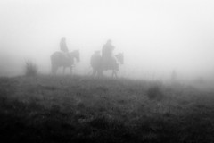
Into The Fog 2
Puebla (Spanish: [ˈpweβla] English: colony, settlement), officially Free and Sovereign State of Puebla (Spanish: Estado Libre y Soberano de Puebla), is one of the 32 states which comprise the Federal Entities of Mexico. It is divided into 217 municipalities and its capital is the city of Puebla.
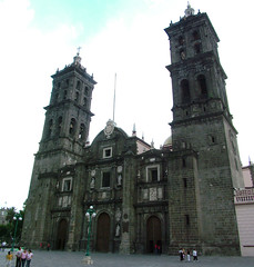
It is located in east-central Mexico and is bordered by the states of Veracruz to the north and east, Hidalgo, México, Tlaxcala and Morelos to the west, and Guerrero and Oaxaca to the south. The origins of the state lie in the city of Puebla, which was founded by the Spanish in this valley in 1531 to secure the trade route between Mexico City and the port of Veracruz. By the end of the 18th century, the area had become a colonial province with its own governor, which would become the State of Puebla, after the Mexican War of Independence in the early 19th century. Since that time the area, especially around the capital city, has continued to grow economically, mostly through industry, despite being the scene of a number of battles, the most notable of which being the Battle of Puebla. Today, the state is one of the most industrialized in the country, but since most of its development is concentrated in Puebla and other cities, many of its rural areas are undeveloped.
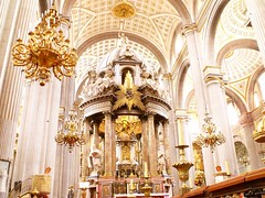
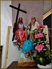
Culturally, the state is home to the china poblana, mole poblano, active literary and arts scenes, and festivals such as Cinco de Mayo, Ritual of Quetzalcoatl, Day of the Dead celebrations (especially in Huaquechula) and Carnival (especially in Huejotzingo). It is home to five major indigenous groups: Nahuas, the Totonacs, the Mixtecs, the Popolocas and the Otomi, which can mostly be found in the far north and the far south of the state.
Geography
The state is in the central highlands of Mexico between the Sierra Nevada and the Sierra Madre Oriental. It has a triangular shape with its narrow part to the north. It borders the states of Veracruz, Oaxaca, Guerrero, Morelos, State of Mexico, Tlaxcala and Hidalgo. The state occupies 33,919 km2, ranking 20th of 31 states in size, and has 4,930 named communities.
Mountains
Most of its mountains belong to the Sierra Madre Oriental and the Trans-Mexican Volcanic Belt. The first is locally called the Sierra Norte del Puebla, entering the state from the northwest and then breaks up into the smaller chains of Sierra de Zacapoaxtla, Sierra de Huauchinango, Sierra de Teziutlán, Sierra de Tetela de Ocampo, Sierra de Chignahuapan and Sierra de Zacatlán, although these names may vary among localities. Some of the highest elevations include Apulco, Chichat, Chignahuapan, Soltepec and Tlatlaquitepec. The highest elevations are the volcanoes Pico de Orizaba or Citlaltepetl (5,747masl), Popocatépetl (5,452masl), Iztaccíhuatl (5,286masl) and Malinche (4,461masl) which are found on the state's borders with Veracruz, Mexico State and Tlaxcala respectively. In the south of the state, the major elevations are the Sierra de Atenahuacán, Zapotitlán, Lomerio al Suroeste and the Sierra de Tehuacán. Dividing much of the state from Veracruz is a small chain of mountains called the Sierra Madre del Golfo.
The natural geography of the state subdivides into the Huasteco Plateau, Llanuras y Lomeríos zone, Lagos y Volcanes del Anáhuac, Chiconquiaco, Llanuras y Sierras de Querétaro e Hidalgo, Cordillera Costera del Sur, Mixteca Alta, Sierras y Valles Guerrenses, Sierras Centrales de Oaxaca, Sierras Orientales and Sur de Puebla. The Huasteco Plateau and the Llanuras y Lomeríos zone are located in the north and northeast, with the Lagos y Volcanes del Anáhuc in the center and north. Together, they account for over 50% of the state. The east and northeast are occupies by the Chiconquiaco and Llanudras y Sierras de Querétaro e Hidalgo areas and account for about three percent of the state. The Cordillera del Sur and Mixteca Alta are located in the west and southwest covering less than 2.5% of the state. The Sur de Puebla is in the southwest and accounts for 26% of the state. Other southern subregions include the Sierras y Valles Guerrerenses, the Sierras Centrales de Oaxaca and the Sierras Orientales. Together, they account for about 15% of the state.
Hydrology
The hydrology of Puebla is formed by three major river systems. One is based on the Balsas River, also known as the Atoyac, which originates with the melting runoff of the Halos, Telapón and Papagayo mountains along with those from the Iztaccihuatl volcano and waters from the Zahuapan River, which enters from Tlaxcala. This river receives further water from tributaries such as the Acateno, Atila, Amacuzac, Molinos and Cohetzala. The river has one major dam called Valsequllo or Manuel Avila Camacho. This river eventually flows west to the Pacific Ocean. The next system empties into the Gulf of Mexico and consists of the Pantepec, Cazones, Necaxa, Laxaxalpan, San Pedro/Zun, Zempoala, Apulco, Cedro Viejo, Salteros, Martínez de la Torre and other rivers on the east side of the state. This system has two major dams called the Necaxa and Mazatepec. The third is the closed Oriental Basin, with a large number of small lakes fresh water springs as well as some volcanically heated springs. The best known of these include Chignahuapan, Agua Azúl, Amalucan, Cisnaqullas, Garcicrespo, Almoloya and Rancho Colorado. Lakes include Chapulco, San Bernardino, Lagunas Epatlán, Ayutla, Almoloyan, Alchichica, Pahuatlán, Las Minas, Aljojuca and Tecuitlapa.
Ecosystems
The state has three main ecosystems, tropical rainforests, forests in temperate and cold areas, and arid and semi-arid zones.
Tropical forests are divided into moist, semi-moist and dry forests. These can be found in the Huasteca Plateau, Chiconguiaco, Lagos y Volcánes de Anahuac, Sur de Puebla, Cordillera Costera del Sur, Sierras y Valles Guerrerenses, Sierras Orientales, Sierras Centrales de Oaxaca and Mixteca Alta. The most common species include Ceiba parviflora, Bursera simaruba, Cedrela odorata, Swietenia macrophylla, Spondias mombin, Brosimum alicastrum, Coccoloba barbadensis, Pithecellobium arboreum, Lysiloma divaricatum, Phoebe tampicensis, Acacia coulteri and Ficus spp. These forests are also exploited for wood and other products, including traditional handcrafts. Low growing plants are used to feed livestock. Little is known about the ecosystems of these forests, but it is known that these areas are important to the regulation of water in area rivers. Human activity has severely damaged over 32,000 hectares.
Tropical forests are divided by altitude. Upper forests are characterized by dense vegetation in fairly humid climates. The tree canopy reaches an average height of 15 meters. Not all species are evergreen, with a number losing leaves during the dry season. During the same season, a number of species also flower. For this reason, these forests never completely lose their color. Common species include Cedrela sp., Brosimum alicastrum, Heliocarpus spp., Calophyllum brasiliense, Zuelania guidonia and Ficus spp. Most forests of this type are located near the borders with Veracruz and Hidalgo. Tropical forests at lower altitudes are found in areas with median temperatures of over 20 C, and annual rainfall of between 800 and . These areas often have a dry season of seven or eight months, and many of these forests will lose most or all of their leaves during this time. Common species include Bursera simaruba, Lysiloma divaricatum, Phoebe tampicensis, Acacia coulteri, Beaucarnea recurvata, Lysiloma acapulcensis and Zuelania guidonia.
Colder pine–oak forests can be found in the Huasteca Plateau, Sierra de Chiconquiaco, Lagos de Volcanos de Anáhuac, Sierras Orientales and Sierras Centrales de Oaxaca. These forests mostly consist of pines, oaks, oyamel fir and other conifers (Abies religiosa, Pinus pseudostrobus, Pinus attenuata, Pinus ayacahuite, Pinus leiophylla, Pinus patula, Pinus teocote, Quercus spp, Quercus rugosa, Alnus spp, Arbutus spp, Cupressus spp and Juniperus spp.). Much of these areas have been extensively logged and some areas are used to farm trees. These trees are used for wood, paper and other wood-derived products. Due to human activity over 107,000 hectares are considered to be severely damaged.
Temperate and cold area forests cover just under 22% of the surface of the state with various species of pine accounting for more than 80% of the trees. These are mostly found in the higher elevations of the mountains where the average temperature is around 15C and at heights of between 2,500 and 2,750masl. Above 3,000m Pinus hartwegii is dominant. Pine species which are the most economically valuable and include Pinus montezumae, Pinus pseudostrobus, Pinus ayacahuite, Pinus greggii, Pinus hartwegii, Pinus lawsonii, Pinus leiophylla, Pinus michoacana, Pinus oocarpa, Pinus patula and Pinus teocote. The second most common kind of forest is dominated by oyamel fir, often intermingling with pines and oaks. These forests are found at altitudes of between 2,500 and 3,600masl and with an average temperature of between 7 and 15C and annual precipitation of . Forests with trees such as Juniperus spp., Pseudotsuga spp., Pseudotsuga menziesii, and Cupressus lindleyi can also be found.
The arid and semi arid area can be found in the Lagos y Volcanes de Anáhuac, Sur de Puebla, Cordillera Costera del Sur, Sierras y Valles Guerrerenses, Sierras Orientales and Sierras Centrales de Oaxaca. Types of vegetation often found includes mesquite, huizachal and agave, with species such as Agave spp, Yuca spp, Opuntia spp, Aristida spp., and Stipa spp. There is no forestry here but a number of plants are used for fibers, waxes, resins, handcrafts, medicine and a number are edible to both humans and livestock. Many of these arid areas subdivide into microclimates depending on minor variations in temperature and precipitation. Some areas, especially dry grasslands, have suffered overgrazing and soil erosion.
In the south, near Puebla's borders with Oaxaca and Guerrero a…


Looking for places related to Puebla?
Those are other destinations to find places related to Puebla: