Susquehanna River
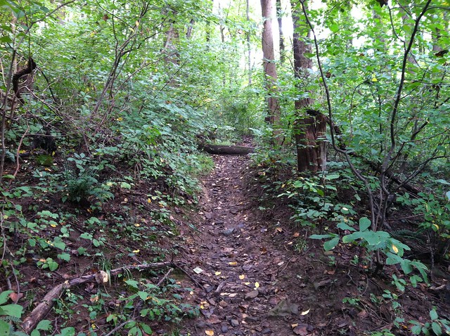
Susquehanna State Park - "Extremely Difficult" Trail
The Susquehanna River (English: /ˌsʌskwəˈhænə/; Lenape: Siskëwahane) is a major river located in the Mid-Atlantic region of the United States, overlapping between the lower Northeast and the Upland South. At long, it is the longest river on the East Coast of the United States. By watershed area, it is the 16th-largest river in the United States, and also the longest river in the early 21st-century continental United States without commercial boat traffic.
The Susquehanna River forms from two main branches: the North Branch, which rises in Cooperstown, New York, and is regarded by federal mapmakers as the main branch or headwaters, and the West Branch, which rises in western Pennsylvania and joins the main branch near Northumberland in central Pennsylvania.
The river drains , including nearly half of the land area of Pennsylvania. The drainage basin includes portions of the Allegheny Plateau region of the Appalachian Mountains, cutting through a succession of water gaps in a broad zigzag course to flow across the rural heartland of southeastern Pennsylvania and northeastern Maryland in the lateral near-parallel array of mountain ridges. The river empties into the northern end of the Chesapeake Bay at Perryville and Havre de Grace, Maryland, providing half of the Bay's freshwater inflow. The bay lies in the flooded valley, or ria, of the Susquehanna.
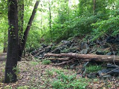
Geology
The Susquehanna River is one of the oldest existing rivers in the world, being dated as 320–340 Myr, older than the mountain ridges through which it flows. These ridges resulted from the Alleghenian orogeny uplift events, when Africa (as part of Gondwana) slammed into the Northern part of Euramerica. The Susquehanna basin reaches its ultimate outflow in the Chesapeake Bay. It was well established in the flat tidelands of eastern North America during the Mesozoic era about 252 to 66 million years ago. This is the same period when the Hudson, Delaware and Potomac rivers were established.
Course
Both branches and the lower Susquehanna were part of important regional transportation corridors. The river was extensively used for muscle-powered ferries, boats, and canal boat shipping of bulk goods in the brief decades before the Pennsylvania Canal System was eclipsed by the coming of age of steam-powered railways. While the railroad industry has been less prevalent since the closures and mergers of the 1950s–1960s, a wide-ranging rail transportation infrastructure still operates along the river's shores.
North Branch Susquehanna
Also called the Main Branch Susquehanna, the longer branch of the river rises at the outlet of Otsego Lake in Cooperstown, New York. From there, the north branch of the river runs west-southwest through rural farmland and dairy country, receiving the Unadilla River at Sidney. It dips south into Pennsylvania briefly to turn sharply 90 degrees west at Susquehanna and again 90 degrees north at Great Bend hooking back into New York. It receives the Chenango in downtown Binghamton. After meandering westwards, it turns south crossing the line again through the twin towns of Waverly, New York, and Sayre, Pennsylvania, and their large right bank railyard, once briefly holding the largest structure in the United States devoted to the maintenance and construction of railroad locomotives.
A couple of miles south, in Athens Township, Pennsylvania, it receives the Chemung from the northwest. It makes a right-angle curve between Sayre and Towanda to cut through the Endless Mountains in the Allegheny Plateau of Pennsylvania. It receives the Lackawanna River southwest of Scranton and turns sharply to the southwest, flowing through the former anthracite industrial heartland in the mountain ridges of northeastern Pennsylvania, past Pittston City (Greater Pittston), Wilkes-Barre, Nanticoke, Shickshinny, Berwick, Bloomsburg, and Danville, before receiving the West Branch at Northumberland.
West Branch Susquehanna
The origin of the official West Branch is near Elmora, Pennsylvania, in northern Cambria County near the contemporary and US Route 219 (locally Plank Road). It travels northeasterly through the towns of Northern Cambria, Cherry Tree, Burnside, Mahaffey and Curwensville (where the river is dammed to form a lake), into and through Clearfield, where it receives Clearfield Creek.
The West Branch turns to the southeast and passes Karthaus (at Mosquito Creek), Keating (at Sinnemahoning Creek), Renovo and Lock Haven, where it receives Bald Eagle Creek. It passes Williamsport, where both Lycoming Creek and Loyalsock Creek empty into it, then turns south, passing Lewisburg, before joining the North Branch flowing from the northwest at Northumberland.
Main Susquehanna flow
Downstream from the confluence of its branches in Northumberland, the river flows south past Selinsgrove, where it is joined by its Penns Creek tributary, and cuts through a water gap at the western end of Mahantongo Mountain. It receives the Juniata River from the northwest at Duncannon, then passes through its last water gap, the Susquehanna Gap through the Blue Mountain Ridge, just northwest of Harrisburg.
Downtown Harrisburg developed on the east side of the river, which is nearly a mile wide here. Harrisburg is the largest city located on the lower river, which flows southeast across South Central Pennsylvania, forming the border between York and Lancaster counties, and receiving Swatara Creek from the northeast. It crosses into northern Maryland approximately northeast of Baltimore and is joined by Octoraro Creek from the northeast and Deer Creek from the northwest. The river enters the northern end of the Chesapeake Bay at Havre de Grace. Concord Point Light was built here in 1827 to accommodate the increasing navigational traffic.
Etymology
"Susquehanna" may come from the Lenape (Delaware) word siskëwahane meaning "Muddy River". Alternatively, it may come from the Len'api term Sisa'we'hak'hanna, which means "Oyster River". Oyster beds were widespread in the bay near the mouth of the river, which the Lenape farmed. They left oyster shell middens at their villages. A third account translates "Susquehanna" from Susquehannock language as "the stream that falls toward the south" or "long-crooked-river".
The Len'api were an Algonquian-speaking Native American people who had communities ranging from coastal Connecticut through New York and Long Island, and further south into New Jersey and Delaware in the mid-Atlantic area. Their settlements in Pennsylvania included Con'esto'ga ("Roof-place" or "town", modern Washington Boro, Lancaster County), also called Ka'ot'sch'ie'ra ("Place-crawfish", modern Chickisalunga, Lancaster County), or Gasch'guch'sa ("Great-fall-in-river", modern Conewago Falls, Lancaster County). They were called Minquas ("quite different"), or Sisa'we'hak'hanna'lenno'wak ("Oyster-river-people") by others. The Len'api also called the area Sisa'we'hak'hanna'unk ("Oyster-river-place").
Peoples of the mid-Atlantic Coast included coastal peoples who spoke Algonquian languages, such as the Len'api (whose bands spoke three dialects of Lenape), and Iroquoian languages-speaking peoples of the interior, such as the Eroni and the Five Nations of the Iroquois League, or Haudenosaunee. The English of Pennsylvania referred to the Eroni people of Conestoga as "Susquehannocks" or "Susquehannock Indians", a name derived from the Lenape term. In addition, John Smith of Jamestown, Virginia, labeled their settlement as "Sasquesahanough" on his 1612 map when he explored the upper Chesapeake Bay area.
In Virginia and other southern colonies, Siouan-speaking tribes constituted a third major language family, with their peoples occupying much of the middle areas of the interior. Iroquoian speakers, such as the Cherokee and Tuscarora peoples, generally occupied areas to the interior near the Piedmont and foothills.
History
In 1615, the river was traversed by the French explorer Étienne Brûlé. In the 1670s the Conestoga, or Susquehannock people, succumbed to Iroquois conquest by the powerful Five Nations of the Iroquois League based in present-day New York, who wanted to control the fur trade with Europeans. The Susquehannock assimilated with the Iroquois. In the aftermath, the Iroquois resettled some of the semi-tributary Lenape in this area, as it was near the western boundary of the Lenape's former territory, known as Lenapehoking.
The Susquehanna River has continued to play an important role throughout the history of the United States. In the 18th century, William Penn, the founder of the Pennsylvania Colony, negotiated with the Lenape to allow white settlement in the area between the Delaware River and the Susquehanna, which was part of Lenape territory. In late colonial times, the river became an increasingly important transportation corridor, used to ship anthracite coal, discovered by Necho Allen, from its upper reaches in the mountains to the markets downriver.
In 1779 during the American Revolutionary War, General James Clinton led an expedition down the Susquehanna from its headwaters. His party had made the upper portion navigable by damming the river's source at Otsego Lake, allowing the lake's level to rise, and then destroying the dam and flooding the river in order for his flotilla to travel for miles downstream. James Fenimore Cooper described this event in the introduction to his historical novel, The Pioneers (1823).
At Athens, Pennsylvania, then known as Tioga or "Tioga Point", Clinton met with General John Sullivan and his forces, who had marched from Easton, Pennsylvania. Together on August 29, they defeated the Tories and warriors of allied Iroquois bands at the Battle of Newtown (near present-day Elmira, New York). This was part of what was known as the "Sullivan-Clinton Campaign" or the "Sullivan Expedition". They swept through western New York, dominated by the Seneca people, destroying more than 40 Seneca villages, as well as the stores of crops the people had set aside for winter. Many of the …


Hotels Susquehanna River
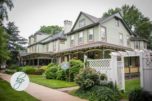 Vandiver InnHavre de Grace
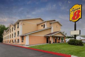 Super 8 by Wyndham Havre De Grace Aberdeen AreaHavre de Grace
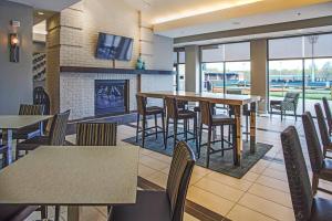 Residence Inn Aberdeen at Ripken StadiumAberdeen
 Courtyard Aberdeen at Ripken StadiumAberdeen
 Comfort Inn & Suites AberdeenAberdeen
 Holiday Inn Express Aberdeen-Chesapeake House, an IHG HotelAberdeen
 Hampton Inn & Suites By Hilton Baltimore/Aberdeen, MdAberdeen
Looking for places related to Susquehanna River?
Those are other destinations to find places related to Susquehanna River:
- Susquehanna
- Broad Creek
- University of Delaw…
- City Bridge
- Conowingo Dam
- Courthouse Historic…
- Concord Point Light
- House
- Mason–Dixon line
- Conowingo, Maryland
- Bohemia
- Lincoln University
- Chambers House
- Bird
- High
- Churchville Presbyt…
- Cecil College
- Bob Carpenter Center
- Armory
- High
- Berkley
- Best Endeavor
- Berkley Crossroads …
- Broad Run