Mount Merapi

Mount Merapi, Gunung Merapi (literally Fire Mountain in Indonesian and Javanese), is an active stratovolcano located on the border between the province of Central Java and the Special Region of Yogyakarta, Indonesia. It is the most active volcano in Indonesia and has erupted regularly since 1548. It is located approximately north of Yogyakarta city which has a population of 2.4 million, and thousands of people live on the flanks of the volcano, with villages as high as above sea level.
Smoke can often be seen emerging from the mountaintop, and several eruptions have caused fatalities. A pyroclastic flow from a large explosion killed 27 people on 22 November 1994, mostly in the town of Muntilan, west of the volcano. Another large eruption occurred in 2006, shortly before the Yogyakarta earthquake. In light of the hazards that Merapi poses to populated areas, it was designated as one of the Decade Volcanoes.
On the afternoon of 25 October 2010, Merapi erupted on its southern and southeastern slopes. A total of 353 people were killed over the next month, while 350,000 were forced to flee their homes; most of the damage was done by pyroclastic flows, while heavy rain on 4 November created lahars which caused further damage. Most of the fissures had ceased erupting by 30 November, and four days later the official threat level was lowered. Merapi's characteristic shape was changed during the eruptions, with its height lowered to .
Since 2010, Merapi had experienced several smaller eruptions, most noticeably two phreatic eruptions which occurred on 18 November 2013 and 11 May 2018. The first and larger of these, caused by a combination of rainfall and internal activity, saw smoke issued up to a height of . There have been several small eruptions since the beginning of 2020, which are of great interest to volcanologists.
Etymology
The name Merapi is a compound of Sanskrit Meru meaning "mountain" with Javanese api which means "fire". Thus Merapi can be loosely translated as "Mountain of Fire" or "Fire Mountain".
History
Geological history
Merapi is the youngest in a group of volcanoes in southern Java. It is situated at a subduction zone, where the Indo-Australian Plate is subducting under the Sunda Plate. It is one of at least 129 active volcanoes in Indonesia, part of the volcano is located in the Southeastern part of the Pacific Ring of Fire—a section of fault lines stretching from the Western Hemisphere through Japan and South East Asia. Stratigraphic analysis reveals that eruptions in the Merapi area began about 400,000 years ago, and from then until about 10,000 years ago, eruptions were typically effusive, and the out flowing lava emitted was basaltic. Since then, eruptions have become more explosive, with viscous andesitic lavas often generating lava domes. Dome collapse has often generated pyroclastic flows, and larger explosions, which have resulted in eruption columns, have also generated pyroclastic flows through column collapse.
Typically, small eruptions occur every two to three years, and larger ones every 10–15 years or so. Notable eruptions, often causing many deaths, have occurred in 1006, 1786, 1822, 1872, and 1930. Thirteen villages were destroyed in the latter one, and 1,400 people were killed by pyroclastic flows.
The very large eruption in 1006 is claimed to have covered all of central Java with ash. The volcanic devastation is claimed to have led to the collapse of the Hindu Kingdom of Mataram; however, the evidence from that era is insufficient for this to be substantiated.
2006 eruption
In April 2006, increased seismicity at more regular intervals and a detected bulge in the volcano's cone indicated that fresh eruptions were imminent. Authorities put the volcano's neighboring villages on high alert and local residents prepared for a likely evacuation. On 19 April smoke from the crater reached a height of , compared to the previous day. On 23 April, after nine surface tremors and some 156 multifaced quakes signalled movements of magma, some 600 elderly and infant residents of the slopes were evacuated.
By early May, active lava flows had begun. On 11 May, with lava flow beginning to be constant, some 17,000 people were ordered to be evacuated from the area and on 13 May, Indonesian authorities raised the alert status to the highest level, ordering the immediate evacuation of all residents on the mountain. Many villagers defied the dangers posed by the volcano and returned to their villages, fearing that their livestock and crops would be vulnerable to theft. Activity calmed by the middle of May.
On 27 May, a 6.3 magnitude earthquake struck roughly southwest of Merapi, killing at least 5,000 and leaving at least 200,000 people homeless in the Yogyakarta region, heightening fears that Merapi would "blow". The quake did not appear to be a long-period oscillation, a seismic disturbance class that is increasingly associated with major volcanic eruptions. A further 11,000 villagers were evacuated on 6 June as lava and superheated clouds of gas poured repeatedly down its upper slopes towards Kaliadem, a location that was located southeast of Mt. Merapi. The pyroclastic flows are known locally as "wedhus gembel" (Javanese for "shaggy goat"). There were two fatalities as the result of the eruption.
2010 eruption
In late October 2010 the Center for Volcanology and Geological Hazard Mitigation, Geological Agency (CVGHM), (Indonesian language—Pusat Vulkanologi & Mitigasi Bencana Geologi, Badan Geologi-PVMBG), reported that a pattern of increasing seismicity from Merapi had begun to emerge in early September.
Observers at Babadan west and Kaliurang south of the mountain reported hearing an avalanche on 12 September 2010. On 13 September 2010 white plumes were observed rising above the crater. Lava dome inflation, detected since March, increased from background levels of to per day to a rate of per day on 16 September. On 19 September 2010 earthquakes continued to be numerous, and the next day CVGHM raised the Alert Level to 2 (on a scale of 1–4). Lava from Mount Merapi in Central Java began flowing down the Gendol River on 23–24 October signalling the likelihood of an imminent eruption.
On 25 October 2010, the Indonesian government raised the alert for Mount Merapi to its highest level (4) and warned villagers in threatened areas to move to safer ground. People living within a zone were told to evacuate. The evacuation orders affected at least 19,000 people; however, the number that complied at the time remained unclear to authorities. Officials said about 500 volcanic earthquakes had been recorded on the mountain over the weekend of 23–24 October, and that the magma had risen to about below the surface due to the seismic activity
After a period of multiple eruptions considered to exceed the intensity and duration of those in 1872 on 10 November 2010 the intensity and frequency of eruptions was noticed to subside. By this time, 153 people had been reported to have been killed and 320,000 were displaced. Later the eruptive activities again increased requiring a continuation of the Level 4 alert and continued provision of exclusion zones around the volcano. By 18 November the death toll had increased to 275. The toll had risen to 324 by 24 November and Syamsul Maarif, head of the National Disaster Mitigation Agency (BNPB) explained that the death toll had risen after a number of victims succumbed to severe burns and more bodies were found on the volcano's slopes.
In the aftermath of the more intensive eruptive activities in late November, Yogyakarta's Disaster Management Agency reported that there were about 500 reported cases of eruption survivors in Sleman district suffering from minor to severe psychological problems, and about 300 cases in Magelang. By 3 December the death toll had risen to 353.
On Friday, 3 December 2010, the head of the National Disaster Management Agency (BNPB), Dr. Syamsul Maarif, M. Si, accompanied by the head of the Centre for Volcanology and Geological Hazard Mitigation CVGHM (PVMBG), Dr. Surono made a joint press release at the BNPB Command Post in Yogyakarta. As of 3 December 2010, at 09.00 am, the CVGHM (PVMBG) lowered the status of Mount Merapi to the level of Caution Alert (Level III). They clarified that with this alert level the potential of hot ash clouds and projected incandescent material remained. The Geological Agency provided several recommendations including that there would be no community activities in the disaster prone areas and proclaimed an ongoing exclusion zone of radius.
2018 eruption
A phreatic eruption began on the morning of 11 May 2018, prompting the evacuation of areas within a radius of the volcano. Adisutjipto International Airport in Yogyakarta was closed due to the eruption's ash plume. This eruption initiated a new phase of dome growth. It led to new evacuations at Merapi in November 2020. The danger of pyroclastic flows was increasing and expanding.
2021 eruption
The eruptions started on 4 January 2021 causing evacuations of the Yogyakarta region. The geological authority had invoked the second-highest alert level in November after sensors picked up increasing activity warning the situation could become more unstable. On 27 March 2021, another small eruption occurred, spewing lava and creating pyroclastic flows. Merapi began erupting once again on 8 August 2021, sending new lava flows down the slope of the volcano. On 16 August 2021, the volcano erupted again, belching a cloud of ash into the air as red lava flowed down its crater. The explosions spewed clouds as far as 3.5 kilometres (2 miles) from the rumbling volcano, blanketing local communities in grey ash.
On 9 December, a pyroclastic flow traveled along the Bebeng River for a distance of 2.2 km. This comes just as Mount Semeru erupted in an unrelated event, killing at least 43 people.
2023 eruptions
An eruption started on 11 March 2023 at around 12 p.m. local time (Western Indonesia Time, GMT…


Hotels Mount Merapi
 Penginapan Mentorogo Kaliurang Mitra RedDoorzKaliurang VII
 Satriafi HotelKaliurang VII
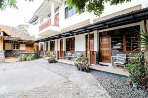 Hotel Wismancala KaliurangKaliurang VII
 Bayu Murti Inn Kaliurang Yogyakarta RedPartnerKaliurang VII
 Hotel SiCantikKaliurang VII
 Hotel Kayu ManisKaliurang VII
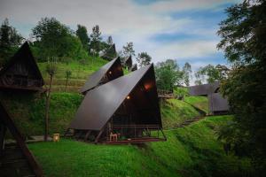 Kema Merbabu powered by CocotelKemangen
 Villa GioKaliurang VII
Looking for places related to Mount Merapi?
Those are other destinations to find places related to Mount Merapi: